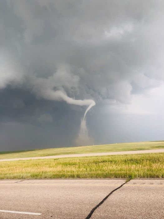
PIERRE/FORT PIERRE — Central South Dakota saw a little bit of everything a severe thunderstorm can bring you Tuesday night. An episode of severe weather started near Pierre at six pm. Shortly after, reports of large hail swarmed the National Weather Service in Aberdeen. The largest hail reported in Pierre officially measured four and a half inches around 6:47 pm. Just a few minutes before that at 6:45 pm the public reported a narrow rope tornado, scouring Stanley County 11 miles south of Fort Pierre. As the storms moved southeast into Lyman, Brule and Buffalo Counties wind reports started to increase. Two semi-trucks were reported as blown over in Lyman County near Oacoma and Reliance just after eight pm. A South Dakota State Mesonet site recorded a wind gust of 100 miles at 8:15 pm two miles west of Oacoma. A gust of 74 miles an hour was reported at Reliance. There were 11 reports of hail at one-inch or larger in the Pierre/Fort Pierre area.