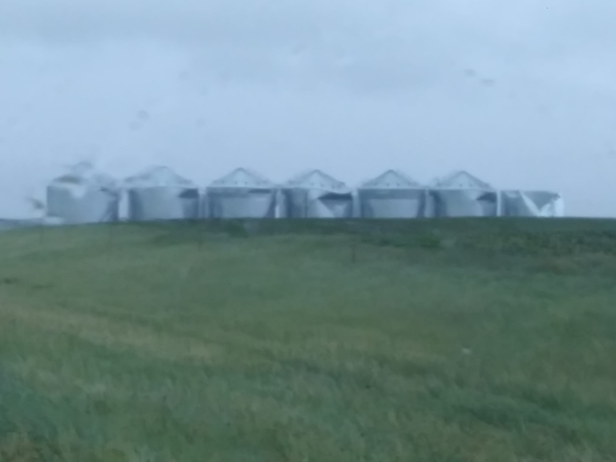
PIERRE — A long line of severe thunderstorms known as a derecho lashed across South Dakota Tuesday. The storms started along the North Dakota/South Dakota border before intensifying in Dewey County where four-inch diameter hail was recorded near Parade. Extensive damage was reported four miles north of Isabel. The storms produced a 91 mile an hour wind gust near the Potter/Sully County line. Damage to grain bins happened four miles north of Onida in Sully County. The National Weather Service received a report of a roof being blown off a home in Highmore in Hyde County. Trees were uprooted and major tree limb damage happened in Miller with nearly full trees blocking roads and knocking out power to Miller and St Lawrence. The ADM-Benson-Quinn grain elevator outside Miller had at least three very large grain bins crushed by the winds. Vehicles were not immune from the damage. An 18-wheeler was blown over three miles west of Miller and a camper being towed by a pick was blown into the south ditch of Highway 14 a mile east of the Hyde/Hand County line. The National Weather Service also issued a pair of tornado warnings during the storm from Sully County to Hand County although no tornado touchdowns have been confirmed by the National Weather Service.


