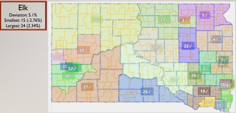
PIERRE — The South Dakota Legislative Research Council has created eight “brainstorm” maps of the way South Dakota’s legislative districts might look like given the current census information and taking other critical factors into account. The maps are named for South Dakota animals and District 24 takes on numerous appearances. The Walleye and Elk maps takes Stanley County out of District 24 and adds Hand and Potter Counties. Mountain Lion is the current District 24 but adds Haakon County. Prairie Dog eliminates Hyde County but adds Jones and Haakon. Canvasback and Rattlesnake would simply add Potter County and Mountain Goat would have Hughes, Stanley, Sully and Potter as a district. In one example, Elk would take Stanley County and include it with Jones, Lyman, Buffalo and Brlue Counties in a District that would include Jerauld, Aurora, northern Charles Mix and Douglas County meaning that district could, in theory run Hayes to Delmont, a distance of up to 214 miles across. The maps are merely examples for legislators to work from as they put together a new map to last until the next Census in 2030. The brainstorm maps can be found here:
https://mylrc.sdlegislature.gov/api/Documents/221275.pdf
